Kilimanjaro Climbing and Trekking tours
Kilimanjaro Climbing and Trekking tours
Kilimanjaro Climbing and Trekking tours
Kilimanjaro Rongai Route: 6-Day Itinerary, Difficulty & Camping Guide
Hike the Kilimanjaro and experience unforgettable wildlife journeys through US
Kilimanjaro Rongai Route 6 Days Itinerary
The Kilimanjaro Rongai Route is one of the most scenic and least crowded ways to summit Mount Kilimanjaro. Approaching from the north near the Kenyan border, this route offers a quieter trekking experience, gradual ascent, and unique views not seen on southern routes.
If you’re planning your climb, this guide covers the Rongai Route Kilimanjaro itinerary, difficulty level, and camping conditions—everything you need to know before choosing this route.
Rongai Route Kilimanjaro Overview
The Rongai Route is the only trail that approaches Kilimanjaro from the north. It is known for:
- Lower traffic compared to popular routes
- Gradual ascent profile (good for beginners)
- Drier conditions (ideal in rainy seasons)
- Stunning views of Mawenzi Peak
However, it is typically completed in 6 or 7 days, and the shorter version has a lower summit success rate due to limited acclimatization.
Rongai Route Kilimanjaro itinerary
- Elevation: ~1,950 m → 2,600 m
- Hiking time: 3–4 hours
- Habitat: Montane forest
You start at Rongai Gate and hike through forest where you might see wildlife like colobus monkeys. The trail is gentle and a good warm-up. Camp at Simba.
- Elevation: 2,600 m → 3,450 m
- Hiking time: 5–6 hours
- Habitat: Moorland
The landscape opens up with great views of the Kenyan plains. You’ll pass First Cave and continue to Second Cave for overnight.
- Elevation: 3,450 m → 3,600 m
- Hiking time: 3–4 hours
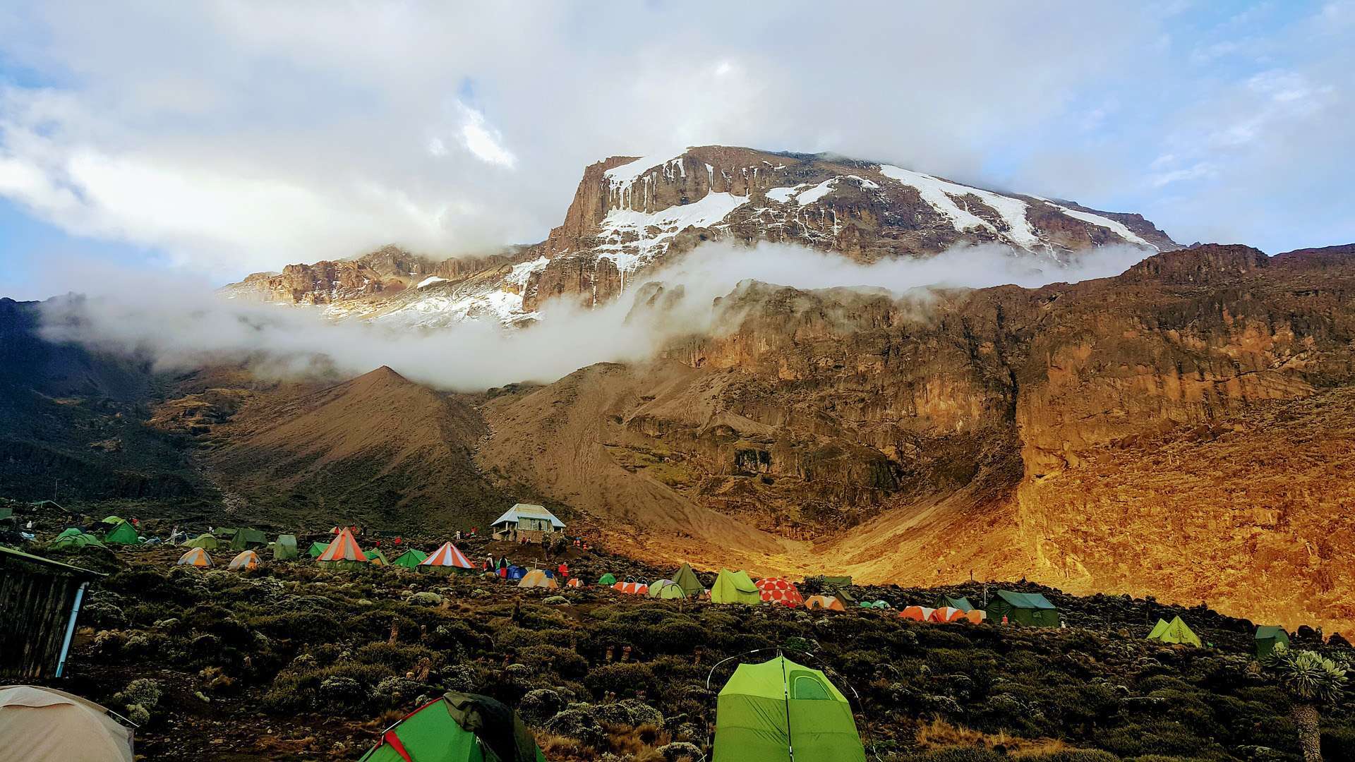
A shorter day to aid acclimatization. The trail becomes steeper as you head toward Kikelewa Camp, surrounded by giant lobelias.
- Elevation: 3,600 m → 4,330 m
- Hiking time: 4–5 hours
You climb to Mawenzi Tarn, located beneath the dramatic spires of Mawenzi Peak. This is a stunning campsite and important for acclimatization.
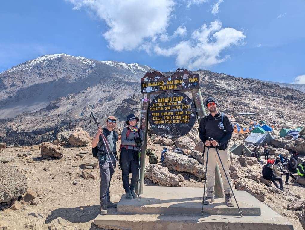
- Elevation: 4,330 m → 5,895 m (Uhuru Peak) → 3,720 m
- Hiking time: 10–14 hours
- Trek to Kibo Hut (base camp)
- Midnight summit attempt to Uhuru Peak
- Pass Gilman’s Point on the crater rim
- Descend all the way to Horombo Camp
This is the toughest and longest day.
- Elevation: 3,720 m → 1,860 m
- Hiking time: 5–7 hours
A long descent through moorland and forest to the exit gate where you receive your summit certificate.
- Elevation: 4,640m → 5,895m → 3,080m | Distance: 17 km total | Time: 10–14 hrs | Habitat: Arctic to Rainforest
- Midnight summit attempt to Stella Point and Uhuru Peak
- Descend to Mweka Camp for overnight
- Elevation: 3,080m → 1,640m | Distance: 10 km | Time: 3–4 hrs | Habitat: Rainforest
- Final descent through rainforest
- Collect summit certificates and transfer to your hotel
Why Choose the Lemosho Route
- More remote and scenic than Machame or Marangu
- Passes Shira Plateau and connects with Machame Route via Lava Tower
- Wildlife sightings possible: buffalo, elephant, monkeys, and birds
- Longer itinerary allows for better acclimatization and higher summit success
- Ideal for adventurers seeking a combination of scenic trekking and challenge
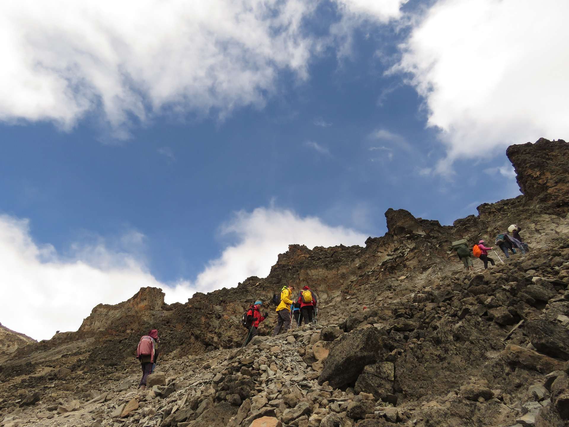
Rongai Route difficulty
The Rongai Route difficulty is generally rated as moderate, but that doesn’t mean it’s easy.
✔️ What Makes It Easier
- Gradual and steady ascent
- Fewer steep climbs early on
- Less crowded trails (better pacing)
⚠️ What Makes It Challenging
- High altitude (up to 5,895 m)
- Long summit day (10–14 hours)
- 6-day itinerary has limited acclimatization
🎯 Difficulty Verdict
- Beginner-friendly? Yes, with good fitness
- Success rate? Moderate (higher on 7-day itineraries)
- Biggest challenge? Altitude, not distance
Rongai Route camping and huts & Accommodation
When planning your climb, understanding Rongai Route camping and huts & accommodation is essential.
🏕️ Camping on Rongai Route
- The Rongai Route is a fully camping route
- Climbers stay in tents at designated camps
- Porters handle tents, cooking, and gear logistics
🛏️ Camps You’ll Stay At
- Simba Camp
- Second Cave Camp
- Kikelewa Camp
- Mawenzi Tarn Camp
- Kibo Hut area (camping nearby)
- Horombo Camp (final night, still camping)
🏠 Are There Huts?
- ❌ No huts are used on the Rongai Route
- ✔️ Huts exist only on the Marangu Route
👉 If you prefer beds instead of tents, the Marangu Route is your only Kilimanjaro option.
FAQ – Lemosho Route
Q: How long is the Rongai Route?
A: The Rongai Route is approximately 70 km (43 miles) and is typically completed in 6 to 7 days, though longer itineraries improve acclimatization.
Q: How difficult is the Rongai Route?
A: The Rongai Route difficulty is moderate, making it suitable for beginners with good fitness, but altitude remains a major challenge.
Q: Is the Rongai Route good for beginners?
A: Yes, thanks to its gradual ascent and lower traffic, it’s considered one of the best routes for first-time Kilimanjaro climbers.
Q: Are there huts on the Rongai Route?
A: No, the Rongai Route is a camping-only route. Climbers sleep in tents throughout the trek.
Q: What is the success rate of the Rongai Route?
A: Success rates vary, but the 6-day itinerary has lower success rates compared to 7-day versions due to less acclimatization time.
Q: When is the best time to climb the Rongai Route?
A: The best time is during:
- January to March
- June to October
It’s also a good option during rainy seasons because the northern side is drier.
Q: Where does the Rongai Route start?
A: The route begins on the northern side of Mount Kilimanjaro, near the Kenyan border.
Plan Your Kilimanjaro Climb
Ready to take on the Kilimanjaro Rongai Route? Our expert team will help you plan every detail—from preparation to summit—ensuring a safe and unforgettable experience on Mount Kilimanjaro.